Au
Bull Run Mine
Historic gold property with surface-dump and underground validation targets · Burrows Park / Whitecross Mining District
Project Overview
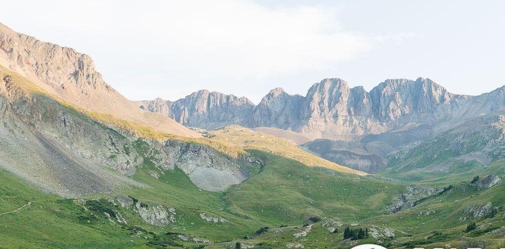
The Bull Run Mine is a high-elevation historic gold property in Hinsdale County, Colorado, at approximately 11,600 feet in the San Juan Mountains near Lake City. A gated haulage adit and approximately 2,800 feet of reported mine development are present, though the modern survey team did not enter the gated adit. A third-party report describes a measured dump of approximately 108 × 134 × 30 feet and calculates approximately 37,989 tons; a separate transaction listing references 38,989 tons. Two grab samples from visibly mineralized dump material returned 0.86 and 0.989 oz/t Au (trace silver). These are selective surface samples — representative dump grade, volume, bulk density, metallurgical recovery, and underground continuity remain to be independently established. No current mineral resource or reserve has been established.
Strategy & Development Path
Current work priorities: independent volumetric survey of dump material via drone photogrammetry, systematic grid sampling with QA/QC, gold deportment and metallurgical testing, and portal safety and underground access assessment.
Geological Context
Bull Run lies in the Lake City district of the San Juan volcanic field. USGS Bulletin 478 (1911) documents a district dominated by structurally controlled fissure-vein systems developed in volcanic rocks, with recurring mineral assemblages including quartz, pyrite, galena, sphalerite, chalcopyrite, tetrahedrite, rhodochrosite, barite, telluride minerals, and locally occurring native gold. The bulletin emphasizes that ore commonly occurred in localized pay shoots — restricted portions of veins separated by lower-value or barren sections — rather than evenly throughout an entire vein. This district context explains why isolated high-grade material or historic workings do not prove continuous grade across a whole vein. Property-specific deposit model remains unconfirmed.
What We Know
Surface assay reference (grab samples)Historical Third-Party Report
Two grab samples from visibly mineralized dump returned 0.86 and 0.989 oz/t Au (trace Ag). Not representative of full dump.
Source: Bull Run GRMP-43 Report
Dump volume referenceHistorical Third-Party Report
~37,989 tons (report calculation); separate listing references 38,989 tons — discrepancy unresolved
Source: GRMP report and transaction listing
Historical district geologyHistorical Government Record
USGS Bulletin 478 documents structurally controlled polymetallic veins with pay-shoot behavior in the Lake City district
Source: USGS Bulletin 478, 1911
Claim serialVerified Official Record
CO101646557 / federal ID CMC290447 recorded with BLM
Gnome relationshipHistorical Third-Party Report
GRMP report treats Gnome as a separate working approximately one mile away — relationship requires reconciliation
Technical Notes & Disclosures
Historical production, assay, tonnage, mineralization, appraisal, and development references are drawn from records of varying age, provenance, and technical quality. Unless explicitly identified as current independent work, they have not been verified by Sovereign Resource Holdings or a Qualified Person and should not be interpreted as a current mineral resource, mineral reserve, economic project, recoverable inventory, or property valuation.
Source discrepancies being reconciled:
- Dump tonnage: 37,989 tons (report calculation) vs. 38,989 tons (transaction listing)
- GRMP field notes reference 50,000–100,000 ton estimate vs. 37,989-ton headline
- GRMP report treats Gnome as separate working ~1 mile away; earlier materials conflate Bull Run and Gnome
- Assay headline (0.9245 oz/t) vs. field note stating assay results were unknown at time of survey
- Access: high-clearance 4WD (GRMP report) vs. 2WD (listing material)
- Upper workings described as 'assumed interconnected' rather than proven connected
Unresolved technical questions:
- Representative dump grade — two selective grab samples do not establish average grade
- Underground condition, ventilation, water, stability — adit was gated, not entered
- Connection between reported crosscuts, raises, and upper levels — assumed, not proven
- Copper, lead, zinc, antimony grades — listed in commodity table but not property-specifically assayed